contacts |
| technologies | ||
|
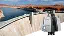
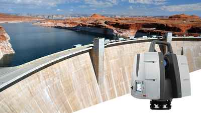
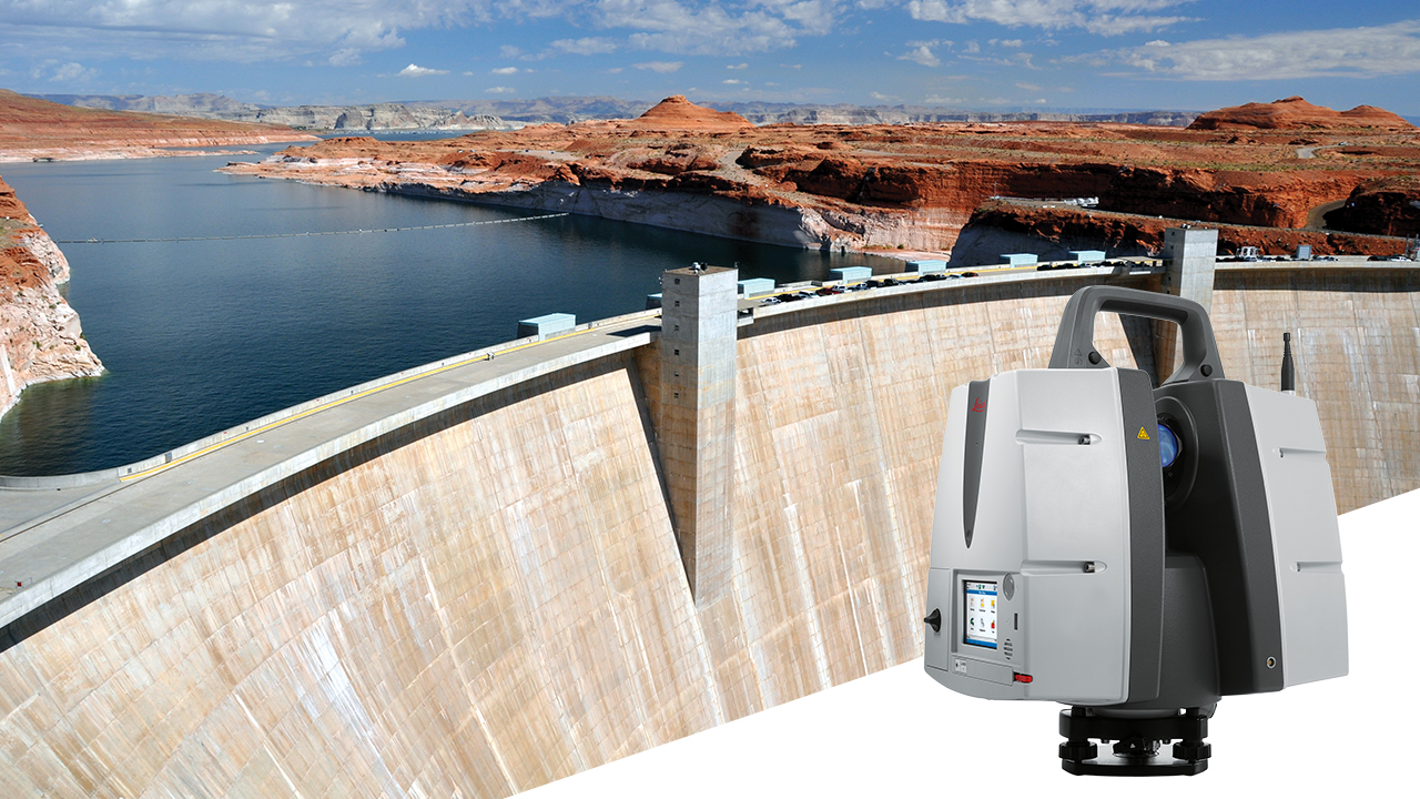
New laser scanner offers up to 1 km long range scanning capability Author Publication Immediately Consecutive No, Short Title 30-2017, Leica ScanStation P50 New laser scanner offers up to 1 km long range scanning capability Leica ScanStation P50 enables users to scan the inaccessible (Heerbrugg, Switzerland, 14 November 2017) – Leica Geosystems, industry leader of measurement technology, announced today the Leica ScanStation P50, the fastest and safest long-range 3D laser scanner, as the newest member of the 3D terrestrial laser scanner P-Series. The new Leica ScanStation P50 delivers highest quality 3D data and HDR imaging at an extremely fast scan rate of 1 mio points per second at ranges of more than 1 kilometre. The new ScanStation P50 combines all the well-known features of the P40 plus a longer-range scanning capability of more than 1 kilometre. Increasing users’ flexibility to offer services in new markets, this rugged and versatile laser scanner enables professionals to 3D capture even at great distances with angular accuracy paired with low range noise and survey-grade dual-axis compensation. Professionals can now scan the inaccessible The ScanStation P50 opens new business opportunities for reality capture professionals, helping them to scan what was previously unreachable such as big mine pits, long bridges, dams and skyscrapers. With a supreme range, the P50 enables users to scan any tall and/or wide infrastructure or dangerous sites from a remote and safe position. The newest member of the P-Series provides the highest quality 3D data and High-Dynamic Range (HDR) imaging at an extremely fast scan rate of up to1 mio points per second and ranges of more than 1 kilometre. “Our customers have requested increased range so that they can capture tall structures and/or far away features without sacrificing the safety of their field crews. During a recent deployment of the Leica P50 in an urban setting, the extended range allowed us to capture more of a city skyline in less setups, ” said Mike Harvey, Leica Geosystems NAFTA HDS product & applications manager. “Due to the extended range, the additional data made scan registration very easy and much faster.” For more information about the Leica ScanStation, please visit: http://leica-geosystems.com/scanstation_p50 Leica Geosystems – when it has to be right Revolutionising the world of measurement and survey for nearly 200 years, Leica Geosystems creates complete solutions for professionals across the planet. Known for premium products and innovative solution development, professionals in a diverse mix of industries, such as surveying and engineering, safety and security, building and construction, and power and plant, trust Leica Geosystems to capture, analyse and present smart geospatial data. With the highest-quality instruments, sophisticated software, and trusted services, Leica Geosystems delivers value every day to those shaping the future of our world. Leica Geosystems is part of Hexagon (Nasdaq Stockholm: HEXA B; hexagon.com), a leading global provider of information technologies that drive quality and productivity improvements across geospatial and industrial enterprise applications. For further information please contact: Leica Geosystems AG Penny Boviatsou Phone: +41 41 727 8960 Fax: +41 (0)71/726-5511 penny.boviatsou@leica-geosystems.com www.leica-geosystems.com |
| |
| technologies | ||
© 2007 | ||